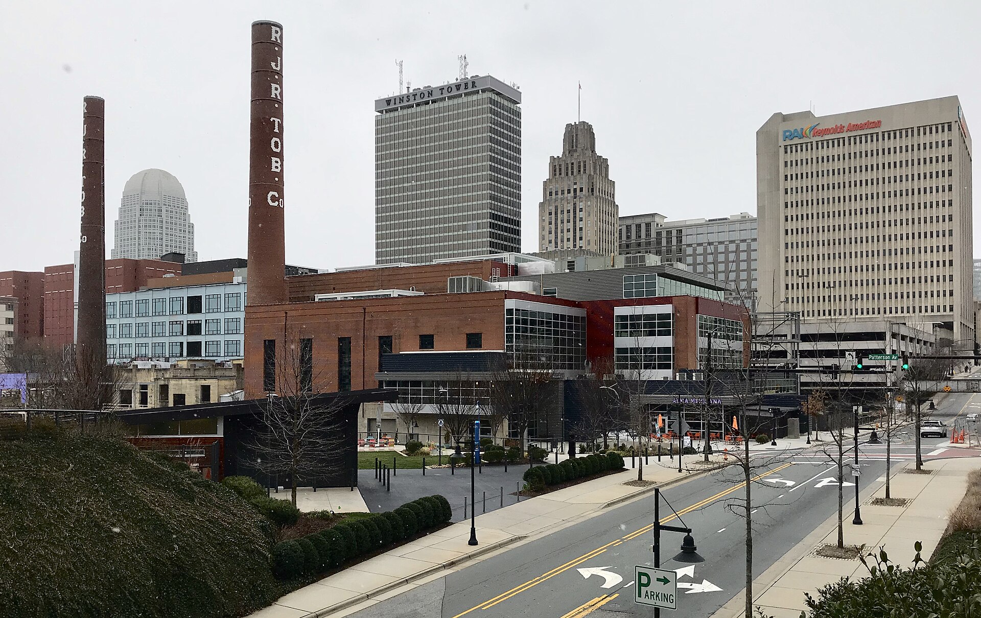
The Winston-Salem skyline and its former tobacco buildings

Outdoors

Boating and kayaking near Winston-Salem

Lakes, reservoirs and rivers near Winston-Salem for boating, kayaking, canoeing and paddleboarding.

25places to boat and paddle
46 mito the closest
April–Octoberbest months

Good to know: Life jackets are required for children on most waters, and many lakes require an invasive-species inspection or a launch fee.

Closest picks

1

Badin Lake Campground

46 mi south · USDA Forest Service

Badin Lake Campground borders the lakeshore and sits within a shaded forest, offering a year-round retreat for swimmers, boaters and anglers in central North Carolina's Uwharrie National Forest.
2

Badin Lake Group Camp

46 mi south · USDA Forest Service

Badin Lake Group Camp offers a fun, relaxing place for clubs, families and other groups to rest and play in the Uwharrie National Forest of central North Carolina.

3

King'S Mountain Point Picnic Pavilion (Nc)

46 mi south · USDA Forest Service

King's Mountain Point Day Use Area is located on the shores of Badin Lake north of Troy, NC in Montgomery County. The biggest fishing hole in the Uwharrie National Forest is Badin Lake.

Map of all 25 places

Map of 25 places loads as you scroll.

30 to 75 miles (15)

46 mi south · USDA Forest Service · Campground

Badin Lake Campground

Badin Lake Campground borders the lakeshore and sits within a shaded forest, offering a year-round retreat for swimmers, boaters and anglers in central North Carolina's Uwharrie National Forest.

  • Boating
  • Camping
  • Fishing
  • Hiking
  • Horseback riding
  • Hunting
  • Swimming
  • Water sports

46 mi south · USDA Forest Service · Campground

Badin Lake Group Camp

Badin Lake Group Camp offers a fun, relaxing place for clubs, families and other groups to rest and play in the Uwharrie National Forest of central North Carolina.

  • Boating
  • Camping
  • Fishing
  • Hiking
  • Horseback riding
  • Hunting
  • Swimming
  • Water sports

46 mi south · USDA Forest Service · Campground

King'S Mountain Point Picnic Pavilion (Nc)

King's Mountain Point Day Use Area is located on the shores of Badin Lake north of Troy, NC in Montgomery County. The biggest fishing hole in the Uwharrie National Forest is Badin Lake.

  • Boating
  • Camping

47 mi south · USDA Forest Service · Campground

Arrowhead Campground

Arrowhead Campground lies in the Badin Lake Recreation Area, a hub for outdoor activities in central North Carolina's Uwharrie National Forest. The variety of sites in the campground offer a comfortable stay for both RV and tent campers.

  • Biking
  • Boating
  • Camping
  • Fishing
  • Hiking
  • Horseback riding
  • Hunting
  • Swimming

47 mi south · USDA Forest Service · Campground

Canebrake Horse Camp

Canebrake Horse Camp lies in the Badin Lake Recreation Area, a hub for outdoor activities in central North Carolina's Uwharrie National Forest. The facility is a scenic and restful overnight spot with both single and double campsites.

  • Biking
  • Boating
  • Camping
  • Hiking
  • Horseback riding
  • Hunting
  • Swimming
  • Water sports

48 mi north · US Army Corps of Engineers · Campground

Philpott Park

Philpott Park is nestled on the shores of Philpott Lake in the rugged foothills of Virginia's Blue Ridge Mountains.

  • Boating
  • Camping
  • Fishing
  • Hiking
  • Swimming

49 mi north · US Army Corps of Engineers

Philpott Lake

Nestled in the rugged foothills within sight of the Blue Ridge Mountains of Virginia are the lake and surrounding public lands of Philpott Lake. The clear water and natural shoreline make Philpott Lake a unique place to visit.

  • Boating
  • Camping
  • Fishing
  • Hiking
  • Nature education
  • Picnicking
  • Water sports
  • Wildlife viewing

50 mi north · US Army Corps of Engineers · Campground

Goose Point

Goose Point Campground is nestled on the shores of Philpott Lake in the rugged foothills of Virginia's Blue Ridge Mountains. The clear water and natural shoreline make Philpott Lake a unique place for visitors.

  • Boating
  • Camping
  • Hiking
  • Swimming

51 mi north · US Army Corps of Engineers · Campground

Salthouse Branch

Salthouse Branch Campground is nestled on the shores of Philpott Lake in the rugged foothills of Virginia's Blue Ridge Mountains.

  • Boating
  • Camping
  • Hiking
  • Picnicking
  • Swimming

52 mi north · US Army Corps of Engineers · Campground

Horseshoe Point

Horseshoe Point Campground is nestled on the shores of Philpott Lake in the rugged foothills of Virgina's Blue Ridge Mountains.

  • Boating
  • Camping
  • Swimming

54 mi west · US Army Corps of Engineers · Campground

Dam Site Shelter

Dam Site Park Shelter is located directly below W. Kerr Scott Dam's visitor center, and features a beautiful view of the dam & reservoir.

  • Boating
  • Camping
  • Nature education
  • Picnicking

54 mi west · US Army Corps of Engineers

W. Kerr Scott Dam & Reservoir

W. Kerr Scott Reservoir is located in the beautiful Yadkin River Valley in Wilkesboro, North Carolina. Authorized purposes of the reservoir are flood control, water supply, recreation, and fish and wildlife management.

  • Boating
  • Camping
  • Fishing
  • Hiking
  • History
  • Nature education
  • Picnicking
  • Water sports

55 mi west · US Army Corps of Engineers · Campground

Bandits Roost

Bandits Roost Campground is located on the south side of W. Kerr Scott Reservoir in western North Carolina. Constructed in the beautiful Yadkin River Valley, the lake offers extensive opportunities for outdoor recreational activities.

  • Biking
  • Boating
  • Camping
  • Fishing
  • Hiking
  • Nature education
  • Swimming

73 mi southeast · US Army Corps of Engineers

B. Everett Jordan Lake

B. E. Jordan Dam and Lake is located near the center of North Carolina with a large population base in a 75-mile radius of the project.

  • Boating
  • Camping
  • Fishing
  • Hiking
  • Nature education
  • Picnicking
  • Water sports
  • Wildlife viewing

73 mi south · Fish and Wildlife Service

Pee Dee National Wildlife Refuge

Pee Dee National Wildlfie Refuge was established in 1963 as a migratory bird sanctuary, specifically to provide habitat for waterfowl and other migratory birds. The refuge includes 8,500 acres, and has a diverse landscape.

  • Birding
  • Boating
  • Fishing
  • Hunting
  • Non-Motorized Boating
  • Photography
  • Ranger programs
  • Wildlife viewing

75 miles and farther (10)

77 mi northwest · National Park Service

Blue Ridge National Heritage Area

The Blue Ridge National Heritage Area is a place unlike any other on Earth, where ancient landscapes enchant the eye and age-old traditions warm the heart.

  • Biking
  • Camping
  • Fishing
  • Hiking
  • History
  • Paddling
  • Picnicking
  • Swimming

86 mi north · USDA Forest Service

George Washington & Jefferson National Forest

  • Biking
  • Boating
  • Camping
  • Climbing
  • Fire Lookouts/Cabins Overnight
  • Fishing
  • Hiking
  • Horse Camping

94 mi east · US Army Corps of Engineers

Falls Lake

The US Army Corps of Engineers and the State of North Carolina would like to welcome you to Falls Lake.

  • Biking
  • Boating
  • Camping
  • Fishing
  • Hiking
  • Hotel/Lodge/Resort Privately Owned
  • Nature education
  • Picnicking

109 mi north · National Park Service

Bluestone National Scenic River

The Bluestone River and the rugged and ancient gorge it has carved is a richly diverse and scenic area of the southern Appalachians.

  • Biking
  • Boating
  • Fishing
  • Hiking
  • Hunting
  • Paddling
  • Wildlife viewing

110 mi south · Fish and Wildlife Service

Carolina Sandhills National Wildlife Refuge

The refuge was established on March 17, 1939 to provide habitat for migratory birds, to demonstrate sound management practices that enhance natural resource conservation, and to provide wildlife-oriented recreation opportunities.

  • Biking
  • Birding
  • Boating
  • Fishing
  • Hiking
  • Hunting
  • Observation Site
  • Paddling

112 mi north · US Army Corps of Engineers

Bluestone Lake

Bluestone Dam spans the New River, forming Bluestone Lake, the third largest lake in West Virginia. With a 2,040 acre surface area, the lake provides boaters, water skiers, and fishermen with great recreational opportunities.

  • Boating
  • Camping
  • Fishing
  • Hiking
  • Hotel/Lodge/Resort Privately Owned
  • Nature education
  • Picnicking
  • Water sports

115 mi east · US Army Corps of Engineers

John H. Kerr Dam and Reservoir

John H. Kerr Dam & Reservoir, also known as Buggs Island Lake, is a 50,000-acre lake extending 39 miles up the Roanoke River along 800 miles of wooded, cove-studded shoreline in Virginia and North Carolina.

  • Boating
  • Camping
  • Fishing
  • Hiking
  • Hotel/Lodge/Resort Privately Owned
  • Nature education
  • Picnicking
  • Water sports

129 mi north · National Park Service

New River Gorge National Park & Preserve

A rugged, whitewater river flowing northward through deep canyons, the New River is among the oldest rivers on the continent.

  • Biking
  • Boating
  • Camping
  • Climbing
  • Fishing
  • Hiking
  • History
  • Horseback riding

134 mi west · USDA Forest Service

National Forests in North Carolina

  • Biking
  • Boating
  • Camping
  • Climbing
  • Fire Lookouts/Cabins Overnight
  • Fishing
  • Hiking
  • Horse Camping

135 mi northwest · US Army Corps of Engineers

R.D. Bailey Lake

Beautiful lake in rugged terrain with visitor center overlooking the lake and many recreational opportunities.

  • Boating
  • Camping
  • Hiking
  • Picnicking
  • Water sports
  • Wildlife viewing

Distances are straight-line miles from downtown Winston-Salem. Listings come from Recreation.gov’s federal recreation database; check each official page for hours, fees, fire restrictions and closures before you go.

Get outside around Winston-Salem

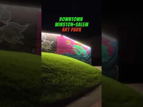
Walking through ARTivity in Winston-Salem NC at Night video thumbnail

THINGS TO DO · YOUTUBE SHORT

Walking through ARTivity in Winston-Salem NC at Night

A local activity Short shared by HotSpot World.

Watch on YouTube ↗

Around Winston-Salem

Old FIre House, Salem Square, Old Salem, Winston-Salem, NC
Old FIre House, Salem Square, Old Salem, Winston-Salem, NC (49036503022)Warren LeMay from Cullowhee, NC, United States · CC0
Trinity Moravian Church, near Sunnyside HD, Winston-Salem
Trinity Moravian Church, near Sunnyside HDNyttend · Public domain
Salem Square, Old Salem, Winston-Salem, NC
Salem Square, Old Salem, Winston-Salem, NC (49036504652)Warren LeMay from Cullowhee, NC, United States · CC0

More outdoors near Winston-Salem

Questions

Where is the closest place for boating & paddling near Winston-Salem?

Badin Lake Campground (USDA Forest Service), about 46 miles south of Winston-Salem as the crow flies. Next are Badin Lake Group Camp (46 mi) and King'S Mountain Point Picnic Pavilion (Nc) (46 mi).

When is the best time for boating & paddling near Winston-Salem?

Based on Winston-Salem’s average highs, April–October. Conditions at higher elevations can be much cooler.

Who manages these places?

Federal agencies including US Army Corps of Engineers, USDA Forest Service, National Park Service. Each listing links to its official page for hours, fees, closures and current conditions.

Winston-Salem AI

Your Winston-Salem local guide
Hey there!

I'm Winston-Salem AI. Ask about neighborhood food, independent shops, local history or planning a visit.

AI recommendations may be inaccurate. Verify hours and prices. Questions are processed by Cloudflare. Privacy